Home About Rivers Inlet Science People Gallery Links Opportunities Contact
Current projects
- Hydrodynamic modeling of surface water flow (Maureen Yeremy)
- Statistical analysis of long term physical data (Laurie Ainsworth)
- Description of the physical oceanography and nutrient budget (Mike Hodal, MSc)
- Environmental factors determining the timing of the spring phytoplankton bloom, and development of a one-dimensional predictive model (Megan Wolfe, MSc)
- The seasonal cycle of primary production (Jade Shiller, MSc)
- Seasonal and inter-annual dynamics of the zooplankton community, and its relationship to variation in the physical environment and phytoplankton production (Desiree Tommasi, PhD)
- Diet and growth rate of juvenile sockeye salmon (Asha Ajmani, MSc)
- Juvenile sockeye salmon biology (Claire Li Loong, MSc)
- Paleoecology of Long Lake (Janice Brahney, PhD)
- Paleoecology of intertidal wetlands (Jonathan Hughes)
Logistics
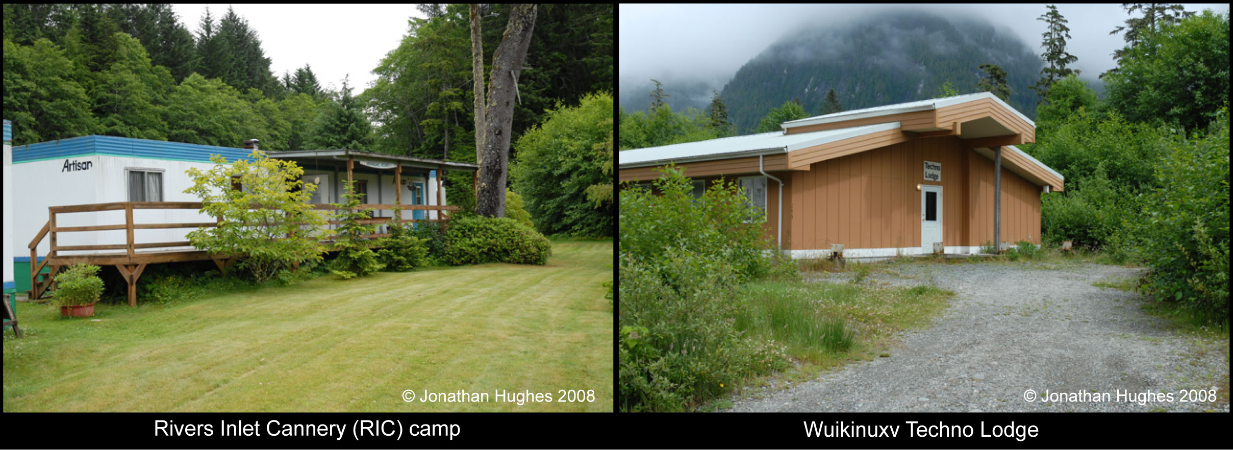
Oceanographic field operations at Rivers Inlet are run from Dawsons Landing cabins. Our primary inlet sampling platform is the MV Western Bounty, a seine boat, owned and operated by the Wuikinuxv First Nations.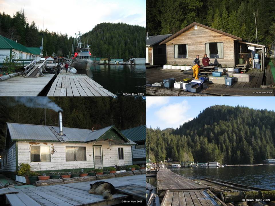
Dawsons Landing
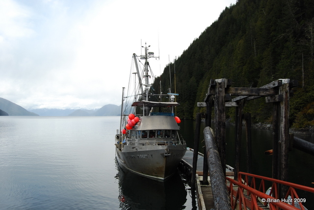
The MV Western Bounty
Field program and data collection
Three autonomous data logging instruments are deployed on a fulltime basis at Rivers Inlet, collecting data continuously:- Wannock River temperature logger
- Fluorescence logger for phytoplankton biomass estimation
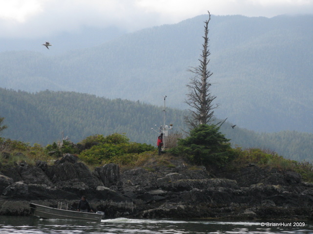
- Weather station
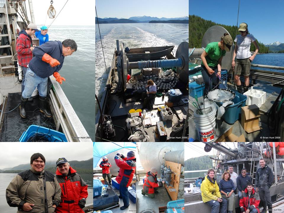
An intensive survey of 10 bio-oceanographic stations is completed aboard the MV Western Bounty every two weeks between late February and September.
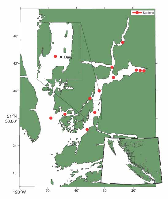
Map illustrating the location of stations sampled during fortnightly bio-oceanographic
surveys, and the daily station. (Figure produced by Mike Hodal)
The aim of these surveys is to obtain a comprehensive bio-physical snapshot of the inlet. Data collected include:
- CTD (Conductivity-Temperature-Depth) probe, light transmission, oxygen -
- Nutrients
- Virus and bacterial biomass
- Bacterial production
- Fluorescence, phytoplankton biomass and community composition
- Primary production, measured with a fast repetition rate fluorometer (FRRF)
- Zooplankton abundance, biomass and species composition
- Frozen samples for stable C and N isotope analysis (food web structure)
The LOPC counts and measures particles in the water column. When housed in a towed body it can be used to collect high spatial and temporal resolution data on the vertical and horizontal distribution of zooplankton. Our LOPC is mounted in a BOT wing, and is integrated with a CTD and fluorometer for concurrent measurement with zooplankton data. Every two weeks, during each bio-oceanographic survey, a repeat LOPC transect is completed across the width of the inlet providing high resolution data for the upper 30m of the water column.
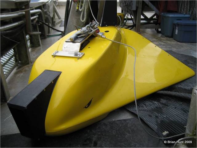
BOT wing housing the Laser Optical Plankton Counter (LOPC)
Seine netting is conducted at 13 stations every two weeks from April to late June. The primary focus of seine netting is to collect juvenile sockeye salmon for growth rate and dietary measurements. The occurrence and quantity of all other fish species collected during surveying is recorded.
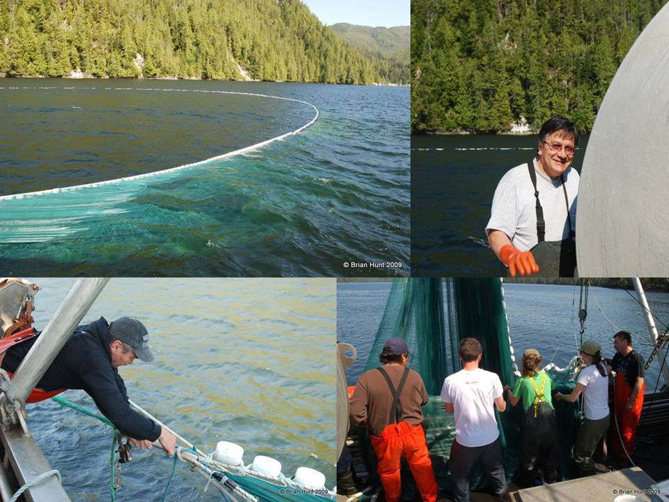
Setting a retrieving the seine net
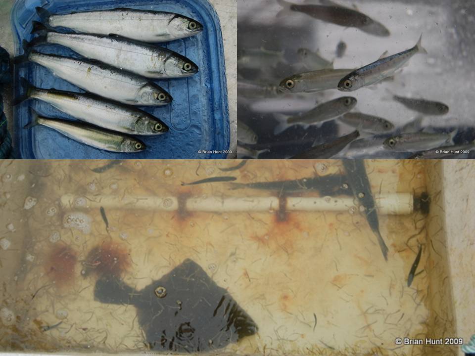
Seine net catch - juvenile sockeye salmon top right
In 2009 pederson gravity cores were collected at three locations in the inlet. Sediment analysis will be used to retrospectively reconstruct inlet sedimentation rates and productivity.
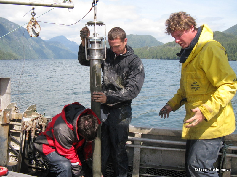
Sediment coring
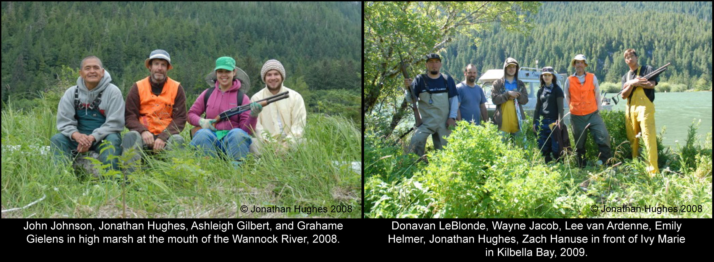
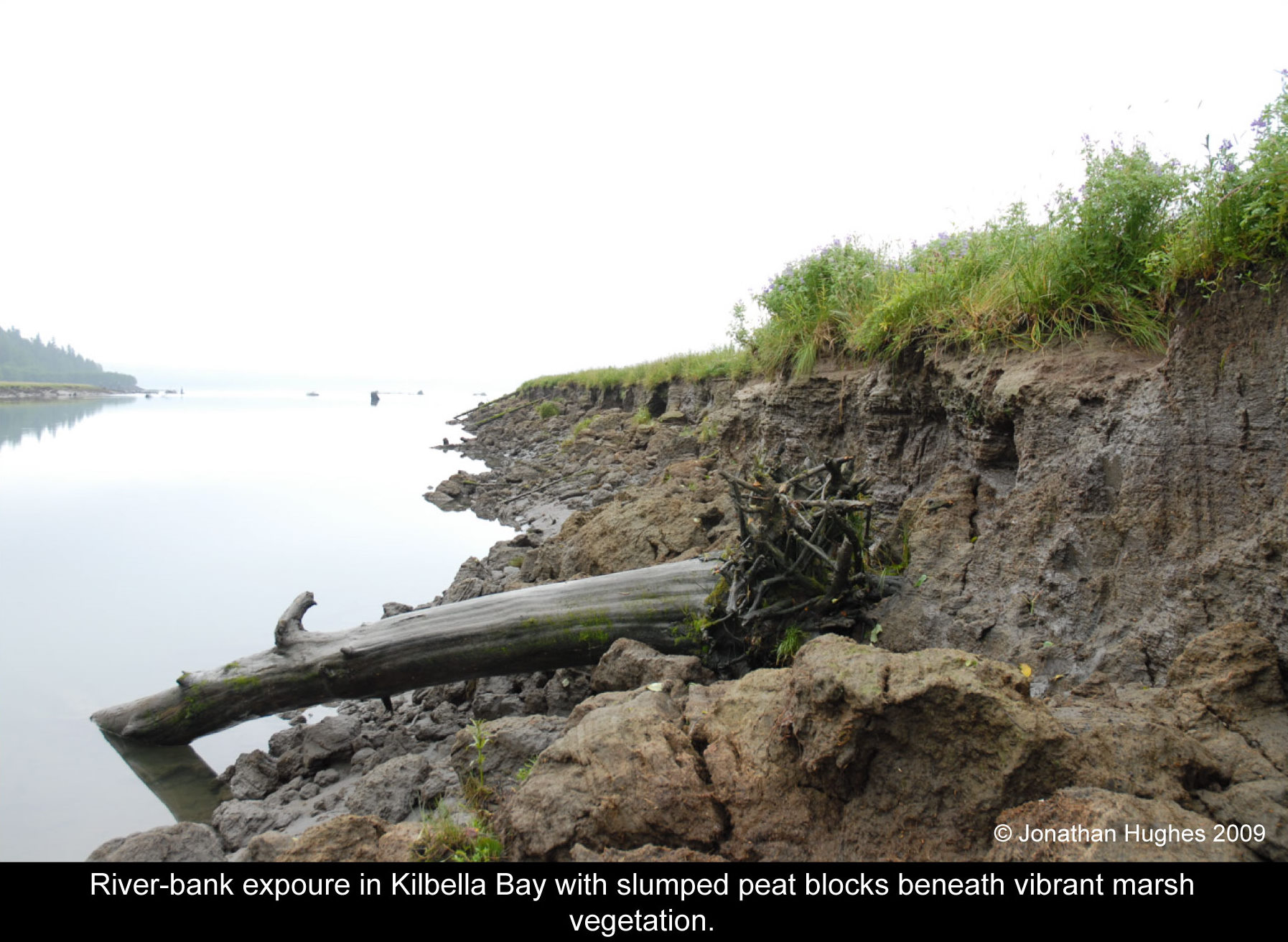
The intent of this multiyear study is to better understand landscape evolution of intertidal wetlands over the last millennium in response to sedimentation and organic matter accumulation at the head of Rivers Inlet. We are particularly interested in understanding the interplay between climate, sedimentation, nutrient cycling, and how these factors influence wetland succession. To this end, we have mapped and sampled intertidal sediments at two estuaries: the Wannock River estuary is located 12 km downstream of Owikeno Lake, while Kilbella Bay is an alluvial-fan delta that receives sediment from two rivers.
Sedimentation patterns and nutrient flux have been assessed using bulk density, total nitrogen, total carbon, radioisotopes of carbon-14, lead-210, and cesium-137. Pollen and spores isolated from these intertidal sediments support distinct floral assemblages that likely correspond to intertidal sediment-accumulation regimes. Sediment stratigraphy beneath a prominent wetland at the mouth of the Wannock river reveals a peaty unit (~30-50 cm depth) that is underlain and overlain by sediments with lower organic-matter content and characterized by low bulk density and high levels of nitrogen and carbon. At Kilbella Bay at least eight discrete sandy units that we interpret as rapid sedimentation events interrupt gradual changes in peat accumulation over time. Comparing intertidal sediments of Kilbella Bay and Wannock River estuaries demonstrates that nearby wetlands can have strikingly different sedimentation histories. Further study of their paleoecological records will link past ecosystem function of wetland plant communities to landscape evolution.
Publications and presentations
Journal Articles- Brahney, J., Bos, D., Routledge, R., and Pellatt, M. 2009. Changes to the productivity and trophic structure of a sockeye salmon rearing lake in British Columbia.North American Journal of Fisheries Management, in press.
- Tommasi, D. Seasonal and interannual variability of primary and secondary productivity in a coastal fjord. MSc Thesis, Simon Fraser University, 2008.
- Buchanan, S. Factors influencing the early marine ecology of juvenile sockeye salmon (Oncorhynchus nerka) in Rivers Inlet, British Columbia. MSc Thesis, Simon Fraser University, 2006.
Conference presentations
- Hughes, J., Helmer, E., van Ardenne, L. (2010) Development of intertidal wetlands at the head of Rivers Inlet, British Columbia, Canada. Society for Wetland Scientists, Pacific Northwest Chapter conference, Bellingham, Washington, USA. Abstract submitted.
- Helmer,
E., Gielens, G., Gilbert, A., and Hughes, J. (2009) Intertidal
sedimentation, peat accumulation, and vegetation community analysis at
the head of Rivers Inlet, British Columbia, Canada. Canadian Quaternary
Association and The Canadian Geomorphology Research Group biennial
meeting, Burnaby, British Columbia, Canada.
- Hodal M. and Pawlowicz R. (2009) Developing a Nutrient Budget for Rivers Inlet, BC. Eastern Pacific Ocean Conference, Sidney, British Columbia, Canada.
- Wolfe M. and Allen S. (2009) Modifying a coupled bio-physical model to predict the timing of the spring bloom in Rivers Inlet, British Columbia. Canadian Meteorological and Oceanographic society Congress, Halifax, Canada.
- Tommasi D., Routledge R., Hunt B., and Pakhomov E. (2009) Variability in the timing of the spring bloom and observed changes in the zooplankton community of a coastal fjord. 3rd GLOBEC Open Science Meeting, Victoria, British Columbia, Canada.
- Tommasi D., Routledge R., Hunt B., and Pakhomov E. (2009) Modeling Spring Phytoplankton Bloom Dynamics in a British Columbia Fjord. Poster Presentation at the 2009 Statistical Society of Canada Annual General Meeting in Vancouver, British Columbia, Canada.
- Routledge, R., Ainsworth, L, Buchanan, S, Cao, J. Springford, A., Tanasichuk, R., and Tommasi, D. Oweekeno Lake sockeye salmon: evidence of critical habitat in the downstream fjord. Presented at the Coastal Ecology Research Foundation Biennial Conference, Portland, OR, November, 2009.
Acknowledgements
Thanks to the Bachen family (Rob, Nola, Krystal and Amber), for making our field base at Dawsons Landing feel like home away from home, regaling us with stories of times past, and helping us overcome some serious logistical hurdles. Special thanks to Krystal Bachen, the primary boat skipper and field assistant for daily sampling.
Thank you to Roger Pieters for continued technical assistance, and to the volunteer students not listed on the website who have thus far assisted with the field program (Kyla Burril, Amy McConnell, Jessica Nephin).
Finally, this project could not be possible without funding support from the Tula Foundation and the vision of Eric Peterson to contribute to conservation, sustainable development and community upliftment on the remarkable and unique British Columbia coast.
